Thursday, September 13, 2018

Kinnickinnic Hidden Falls Change in Season


Two miles past the main entrance to Kinnickinnic State Park is their little known Hidden Falls trail.  I like the fact that it is lightly traveled.  It feels "untouched" yet the park maintains the turf on this trail.  You may encounter an occasional downed tree limb, but nothing that will hamper your enjoyment of this wonderful woodsy walk.

To get to this trail, stay on Country Road F and drive past the signs telling you to turn onto 820th Avenue.  Keep driving down into the valley and around the curved bridge that crosses the Kinnickinnic by the Anglers Lot.   Eventually you will see a sign on your right for 770th Avenue. Follow this road about 1/2 mile and on your right you will see a little dirt parking lot with State Park signage.  If you park in this lot, you will be expected to have a state park sticker but the secret is that you don't have to park in this lot.  You can park along the side of this country road and that is perfectly fine!

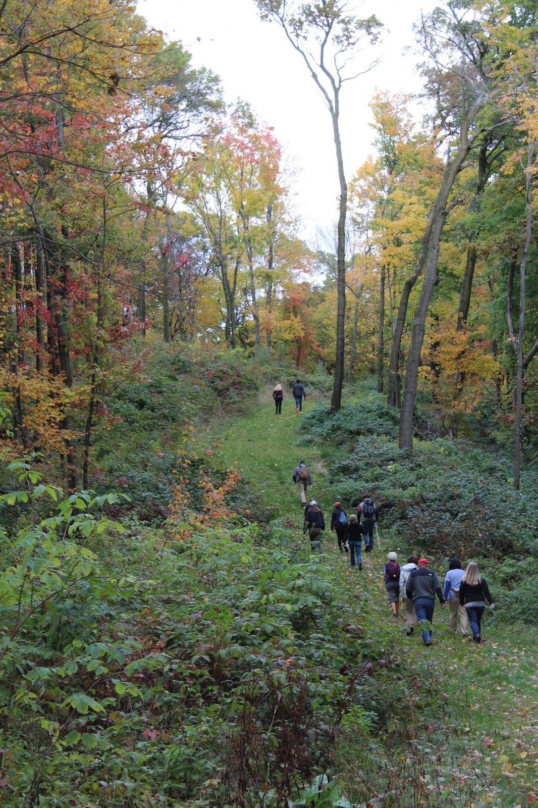
Notice in the picture a trail cut into the prairie leading to the first pine grove? This trail is open to hiking and snow shoe.  In the main park, a lot of the trails are off limits in winter due to skiing but this gem is open to hikers all year round.


TRAIL MAP:


HIKING GUIDE:

This trail when followed in the entire loop and back is just shy of 3 miles (2.9).  It's a perfect winter hike or when you just want a nice walk that can be completed in under an hour.   The first quarter mile is a nice easy walk through the prairie into the pine grove.  The first thing you will notice upon entering the grove is how soft the ground is.  Years of accumulated pine needles make a lovely soft cushion under foot. The trees are dense and the sun is immediately dampened under the branches.  The trail is narrow so you need to walk single file with others.  It meanders through the trees as the trail transitions from pine to hardwood and back again.  The trail is mostly flat with a few small hills and terrain variance.  I know it's tempting to just watch your feet as you walk the narrow path, but take your time to look around. The simple beauty of this place might just take your breath away!  


Keep your eyes open for mushrooms and flowers.  This is a haven for both, spring through fall. 


Halfway through the hike you will come to a lookout.  This is where the falls are located.  In the spring and winter, when the trees are free of leaves, you can see the flowing water of the Kinnickinnic River and the small falls. If you want to get a closer look, it is a steep hike down a ravine (which I haven't done but some of my friends have).  

This is where I took one of my all time favorite pictures.  This picture is printed on a large canvas on my family room wall.  The first time I hiked this trail, it felt magical.  I think I may have called it "a fairy home" or something like that.  I simply love this trail.  Pictures do not do it justice.  


After the falls, the trail continues to meander through the trees on a narrow path.  You will encounter a couple steeper hills but they shouldn't be too challenging. Eventually you will come out of a pine grove back onto the prairie and hike a half mile until you reenter the trees.  More meandering trail through the pine trees. Pay attention to where the foot traffic has been.  It can be easy to step off the trail in here.  Finally you reemerge onto the prairie for the final leg back to the parking lot.

This is a wonderful trail to take your dog for a walk.  Please note, it needs to be on a leash and you need to clean up after it!  Surprisingly, other than birds, I usually don't see other wildlife like deer and rabbits on this trail. Perhaps it's timing on my part, but usually I hike this trail in the late afternoon and evening when deer are most actively moving around.

Make the 30 minute drive from the cities for this park.  I do have one important suggestion however... this park is notorious for heavy mosquitos.  Come in all seasons except mid summer when the bugs are at peak!

Wednesday, September 12, 2018

Hoffman Hills in the Fall

Hoffman Hills State Recreation Area offers 707 acres of preserved and Locationrestored wooded hills, wetlands and prairie traversed with hiking and cross-country ski trails. A 60-foot-high observation tower crowns one of the highest points in Dunn County, offering spectacular views of the surrounding countryside, especially in autumn.

This was copied and pasted directly from the Hoffman Hills Recreation website.


One of the most anticipated hikes of the year among my hiking club members is the fall color hike at Hoffman Hills.  This park offers well maintained trails, a huge variety of terrain, challenging hills, spectacular views and little foot traffic.  I am amazed every year when I come here and there are very few people.  This park is a hidden gem not far from Menomonie and a mere one hour drive from the twin cities. It is totally worth the drive as there are miles of trail and so much to see.

For the best hike, stick to the trails along the outer perimeter. There is heavy tree coverage but there will still be some sun peeking through the trees plus it's easier to navigate. This park could be easy to get lost in if you aren't carrying a map or phone with gps.  Club members love coming here because I do all the navigation and they just hike and enjoy the beautiful fall colors.

TRAIL MAP:

https://dnr.wi.gov/topic/parks/name/hoffmanhills/pdfs/hoffmanhills.pdf

HIKING GUIDE:

Total hiking distance for this hike is about 5.5 miles.  There are challenging hills and if you climb the observation tower, it will be a super workout!

Starting from the main parking lot, head southeast along the Skyline trail. Right away you will come to a steep hill flanked by trees.  The trails here are all packed dirt and grass (which is well maintained). Upon getting to the top of the trail and rounding the curve, you will be greeted with this spectacular sight.


Follow the path as it climbs and descends many hills.  When you come to a path intersection, stay right and follow the Buck Hill Trail. You'll see some amazing views out to the distance from this trail. 


You will come to a three way split in the trail. Stay right and this leads to Hawk Ridge.  There is a steady climb up (the last big climb of the hike).  For extra distance and a wonderful hike along narrower single file trails, stay right to hike on both the South and North Squirrel Tail trails.   These trails are easy but very enjoyable.


Coming off the North Squirrel Tail trail, it's a short hike on Hawk Ridge to the 60 foot observation tower.  

By the time you get to the tower, you will have logged about 3 miles on your hike.  You may be a little tired at this point, but you will want to climb the 100 steps to the top. It is absolutely worth the effort! This is one of the highest points in Dunn County and you can see the entire valley below.  


These pictures just really don't do this view justice!!!  If you decide to hike this park during peak color, you will know what I mean.

Continue downhill on the Sunset trail from the observation tower.  At the end of this trail, you will come to the East Savannah loop.  This is a wonderful hike through the prairie where all of the wild flowers and high grasses grow.  They mow down a nice wide trail for hikers. 


The last leg of the hike travels along the Savannah loop down around Richard's Pond and then around Marion's Pond with the last leg on the Catherine Hoffman Memorial Wetland trail. These pictures were my favorite of the day.  Two of them are actually printed on large canvases that now hang on my walls. 


I had a large hiking crew for this hike!  We all had an amazing time and so will you!


If you only have time for one big fall hike this year, THIS is the one you should take!  I can't wait for the next fall hike at Hoffman Hills and to tell you all about it!

The Start of Something Good...

Two and a half years ago, I decided that the only way I was going to get motivated enough to exercise several times a week was to start a hiking club.  I figured, if I was accountable to someone other than myself, I would be committed to planning a hike and showing up!  Little did I know that this simple journey to get outside more would turn into one of the best decisions of my life.  Along the way, I have discovered some of the most beautiful places I never knew was out there and made many friends who share my passion for the outdoors.  Now, what at first felt like a chore has blossomed into something I wish I could do for my day job!  I love hiking, I love being outdoors and I love all of the friends I have made in this journey to explore and share what I find.

A few months ago, someone messaged me through Facebook.  He had recently moved to the Twin Cities and wanted to start taking his daughters out on daddy daughter hiking excursions.  He wanted some advice on the best parks and the best trails for family hiking.  After rattling off idea after idea over the course of several days, he suggested that I write about all of these places and my hikes.  What a brilliant idea that was and it is finally happening. 

Over the past 2 1/2 years, we have been on hundreds of hikes.  There isn't a trail in the St Croix Valley area that hasn't been explored.  The interesting thing about hiking is that the trails change every time we hike them. Whether it be a change in weather, spotting wildlife, having new conversations and new members on the hike, there is always something new and wonderful to experience.  I take a lot of pictures on my hikes and I use a GPS tracking app to keep track of our route and speed.  This along with information on the difficulty and hike worthiness of trails will all be shared. 

In the coming weeks, I will have a lot of hikes to catch up on and write about.  There are so many in my past that really should be shared.  You will see past hikes as well as current hikes as they happen.  Come back often to check it out and feel free to follow me for all the latest updates!